Some countries aren’t limited to their main borders. They control far-flung overseas territories or odd territories thousands of miles away. These lands often have fascinating histories, unusual governments, and quirky features that surprise even geography buffs. From a tiny rock at the tip of Spain to a French region in South America and a U.S. naval base in Cuba, these examples show that countries sometimes hold territories in the most unexpected places, each with their own unique history, and those disputes continue even today.
Gibraltar — The Rock That Refuses to Quit
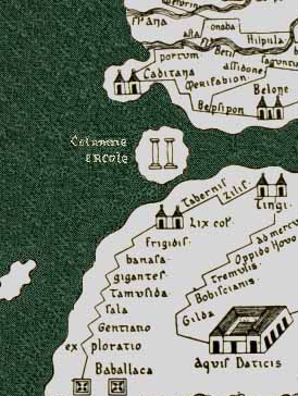
Perched at the southern tip of Spain, Gibraltar is a tiny British territory just 2.59 square miles in size, yet its location at the entrance to the Mediterranean makes it one of the most strategically important points in Europe. Captured by Britain during the War of Spanish Succession in 1713, Gibraltar has resisted Spain’s repeated attempts to reclaim it. Its steep limestone cliffs and commanding views over the Strait of Gibraltar give it a natural defensive advantage, showing how geography can make even a small territory vital for centuries.

The strategic importance of that passage of water goes back to antiquity when it known as the Pillars of Hercules. According to myth, Hercules was tasked with one of his twelve labors, and in the process, he was said to have pushed apart two massive mountains to create a passage from the Mediterranean to the Atlantic Ocean. The current name came in 711 CE when Berber General, Jabal Țāriq, which means “Mountain of Tariq” in Arabic, led the Muslim conquest of Spain. He used the rock as a strategic point to begin the invasion of southern Gibraltar. They stayed for 598 years.

French Guiana — France’s South American Outpost
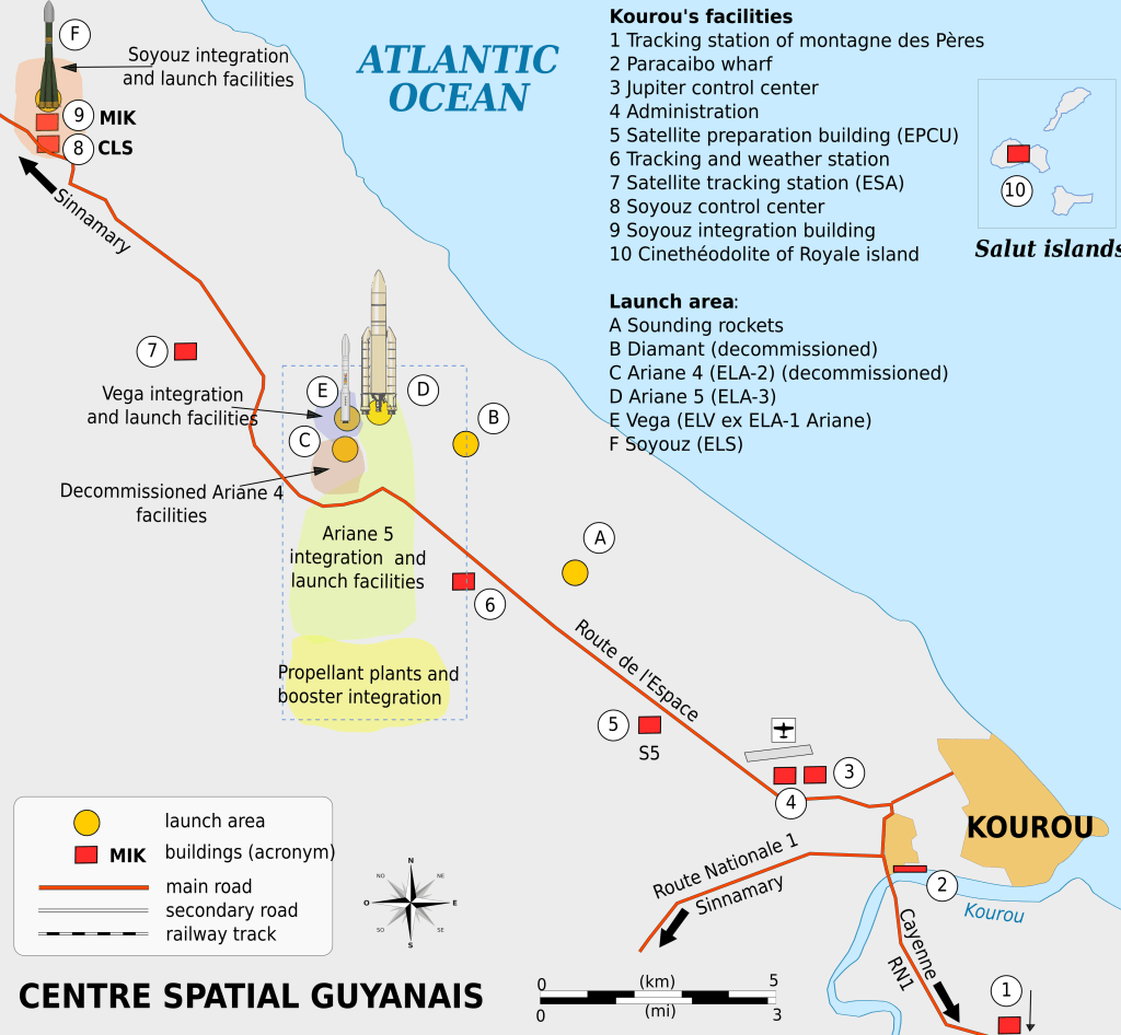
Thousands of miles from Paris, French Guiana sits on the northern coast of South America but remains a French overseas department, meaning residents are full French citizens who use the euro and vote in French elections. This distant territory has more than just political ties. It’s also home to Europe’s Guiana Space Centre, where rockets are launched into space, making it literally a French gateway beyond the planet. This can serve as a cross-curricular discussion of the geography, history, and science of the area.
Guantanamo Bay — The U.S. Lease That Lasts Forever
On the southeastern coast of Cuba lies Guantanamo Bay, a U.S. naval base leased in 1903 after the Spanish-American War. The bay itself is a deep, naturally sheltered harbor, which makes it an ideal location for a naval base even today. While Cuba has long demanded its return, the United States continues to operate the base under a “perpetual lease,” taking advantage of its unique geography to maintain a strategic foothold in the Caribbean.

What Teachers Can Take From Odd Territories
These far-flung territories are more than curiosities, they’re perfect for teaching geography, history, and civics. Students can explore map skills by locating these distant lands, understand how geography influences political power, and analyze why countries maintain territories far from home. Highlighting features like Gibraltar’s cliffs, French Guiana’s equatorial location, and Guantanamo’s natural harbor shows that geography isn’t just background. It shapes history, strategy, and global influence.
Recommended Reading
CIA World Factbook – Gibraltar Factsheet — Straightforward geographic and demographic facts useful for quick classroom charts or student research.
Britannica – French Guiana Geography & History — A student‑accessible article explaining where French Guiana is, its borders, and unique status as part of France on the South American continent.
Guiana Space Center — A French Guiana spaceport near the equator that helps rockets launch more efficiently and safely.
National Geographic Education – Cuba Geography — Lesson ideas and maps that include Guantánamo Bay, ideal for middle and high school classroomNational Geographic Education – Cuba Geography
Recommended Resources
Lyceum of History: Map Lessons — Engaging, ready‑to‑use activities for building map literacy, spatial thinking, and global awareness.
Engaging, ready‑to‑use activities for building map literacy, spatial thinking, and global awareness.
Ryan Wagoner
The Lyceum of History
“I am indebted to my father for living, but to my teacher for living well.” — Alexander the Great
Follow me on: Blog | TpT | YouTube | X | Instagram | Facebook


Leave a comment