Political Borders: More Than Lines on a Map
Political boundaries are often taught as fixed, logical lines on a map, but history tells a much messier story. Many of the world’s strangest borders exist because of colonial negotiations, imperial rivalries, and historical compromises that prioritized power over geography. For social studies teachers, “corky” political boundaries offer an engaging way to teach students about colonialism, geopolitics, and how historical decisions still shape the modern world.
From enclaves and unclaimed land to narrow buffer zones created by empires, unusual political boundaries challenge students to rethink what borders are and why they exist. Examining cases like Baarle-Hertog, Bir Tawil, and the Wakhan Corridor helps students connect geography to history, law, and global power. Rather than hearing a “boring” lecture, it turns maps into a dynamic visual that affects people in real time.
Baarle-Hertog: When Borders Ignore Common Sense
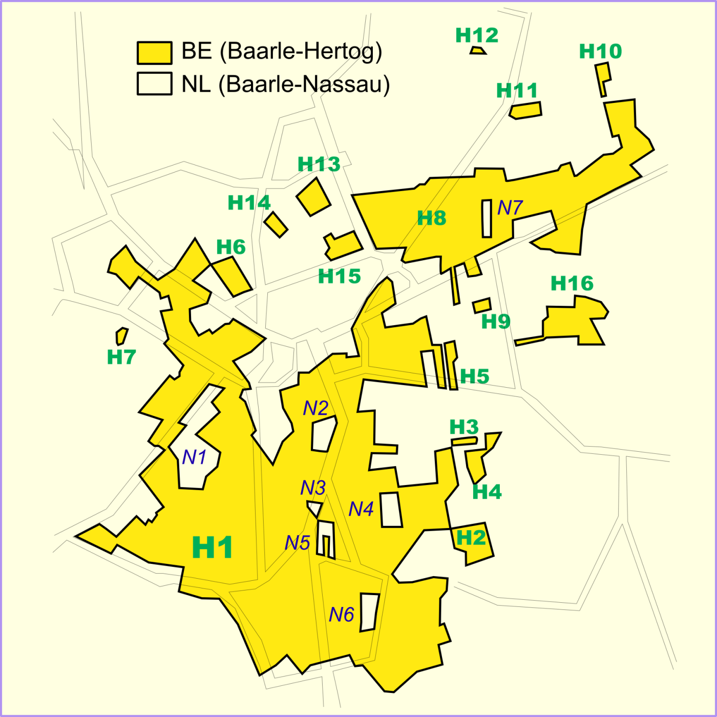
Baarle-Hertog, a Belgian town inside the Netherlands, is one of the strangest border situations in the world. Instead of one clear boundary, the town is split into dozens of Belgian enclaves surrounded by Dutch territory and within some of those are even Dutch enclaves inside Belgium. This patchwork border dates back to medieval land deals between feudal lords, long before modern nation-states existed.
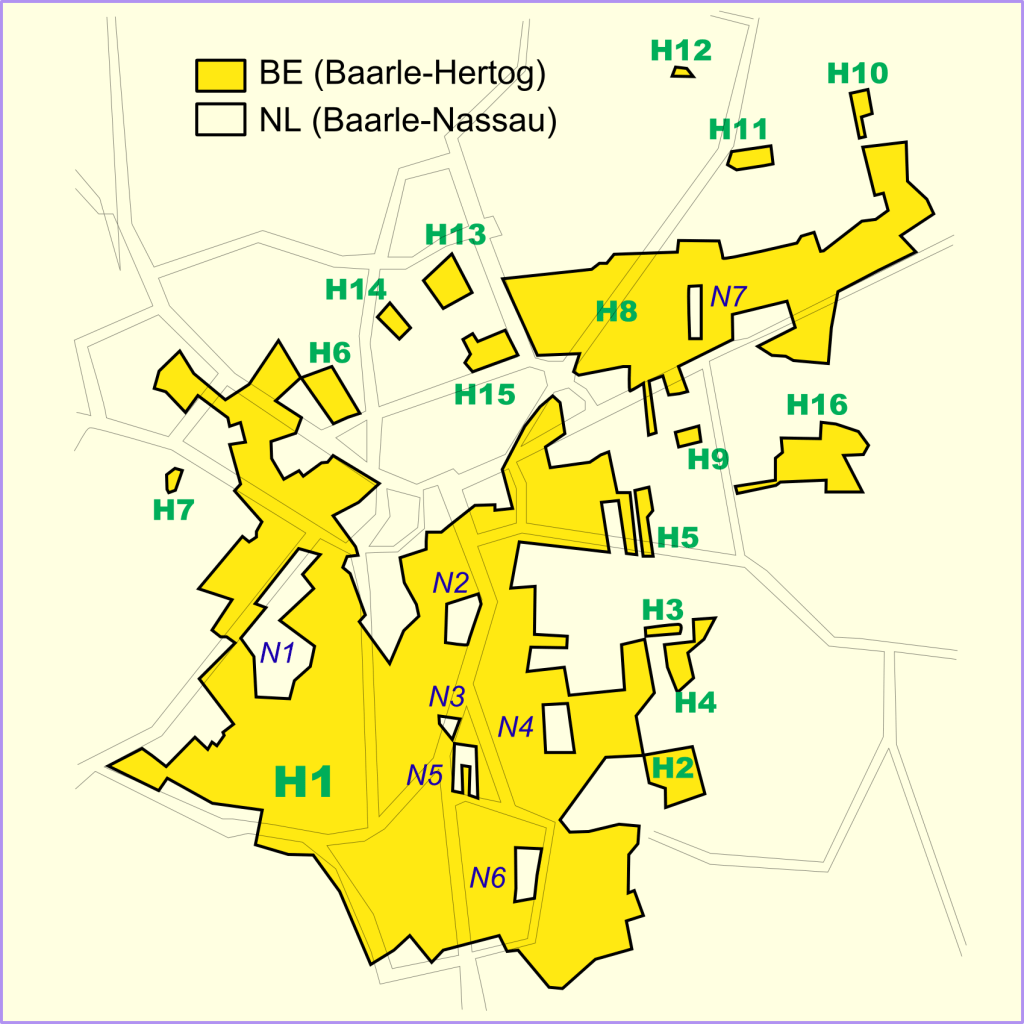
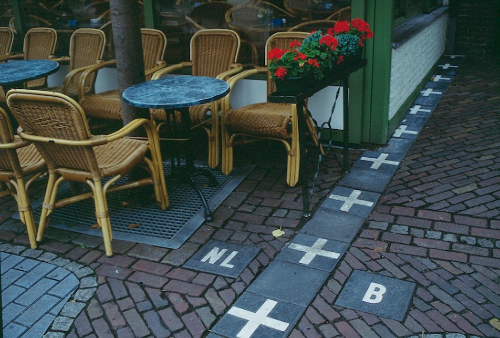
In the classroom, this example invites students to question how medieval property agreements still influence modern governance. Teachers can ask students to imagine everyday life in Baarle-Hertog, where the border can run down a street or cut between neighboring buildings. How would emergency services respond, which school system would residents belong to, or where would they vote? Students quickly see how abstract historical decisions create very real modern consequences.
Bir Tawil: A Place Nobody Wants
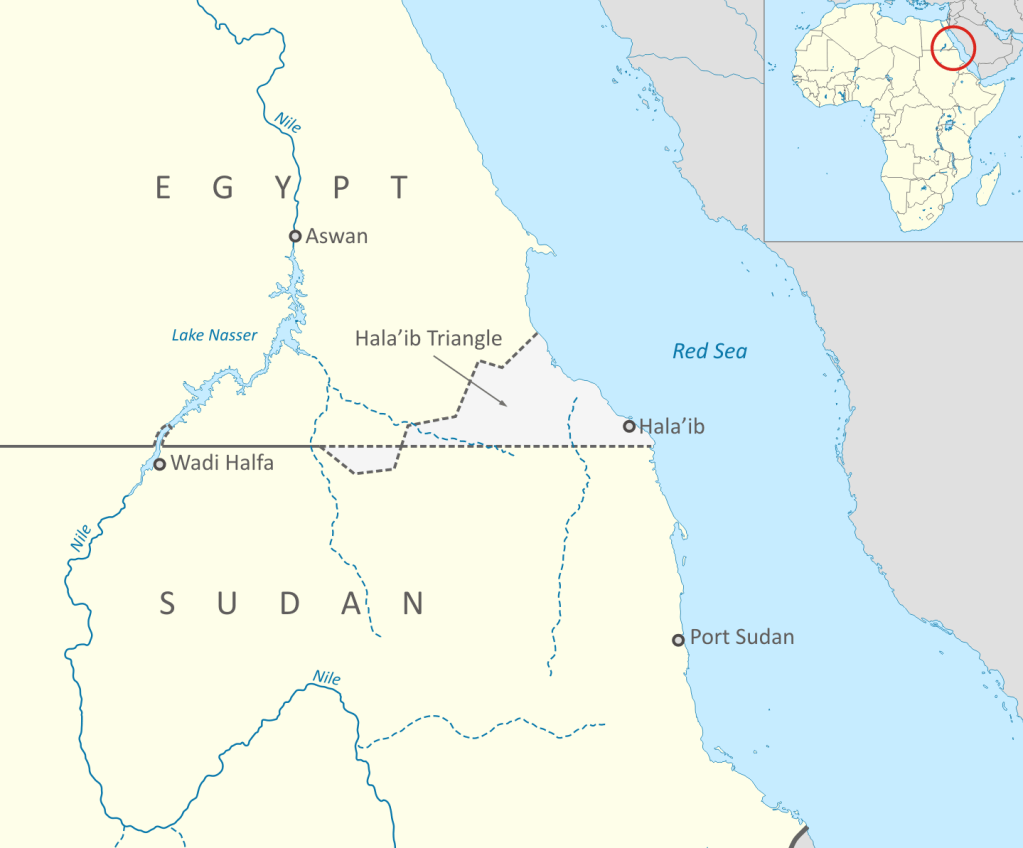
Bir Tawil, a small, barren stretch of land between Egypt and Sudan, is one of the few places on Earth not officially claimed by any country. This oddity exists because of two conflicting borders drawn during British rule in the late 1800s, one based on political convenience, the other on administrative control. Egypt claims one border to maintain control of the more valuable Hala’ib Triangle, while Sudan claims the other. The result is a no-man’s-land that neither country wants.
This case opens the door for discussions about colonialism, legal borders, and national interest. Teachers can ask students why a piece of land might be deliberately ignored and what that reveals about how borders are tied to resources, power, and strategic value. Students often find it surprising that international law allows land to exist without a clear owner, and that recognition matters more than maps.
The Wakhan Corridor: A Buffer Zone Frozen in Time
The Wakhan Corridor, a narrow strip of Afghanistan stretching toward China, looks almost absurd on the map, but its shape tells the story of 19th-century imperial rivalry. During the “Great Game” between the British and Russian Empires, neither side wanted the other as a direct neighbor. The solution was to carve out a long, thin buffer zone separating British India from Russian-controlled Central Asia. The line still sits in the same place today; in fact, the Chinese section of the border wasn’t finalized by treaty until 1963.
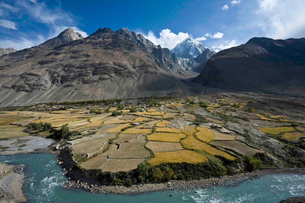
For students, the Wakhan Corridor becomes a powerful example of how global power struggles shape local geography. Teachers can guide students to consider how a border designed for imperial convenience still affects Afghanistan today, isolating communities, complicating governance, and influencing modern geopolitics. This example naturally leads into discussions about how borders created for short-term political goals can produce long-term instability.
Why Corky Borders Matter in the Classroom
These strange boundaries do more than amuse students, they challenge assumptions. By examining Baarle-Hertog, Bir Tawil, and the Wakhan Corridor, students learn that borders are negotiated, contested, and often arbitrary. Teachers can weave these cases into lessons on colonialism, nationalism, and international law, asking students to evaluate whether borders should prioritize history, ethnicity, geography, or political stability.
When students compare these examples, they begin to see patterns: empires drawing lines with little regard for local realities, legal technicalities overriding common sense, and historical compromises solidifying into permanent divisions. These discussions help students understand why borders remain one of the most powerful, and problematic, forces in global politics.
The Bigger Picture
Corky political boundaries remind us that history doesn’t stay in the past. Medieval land grants, colonial maps, and imperial rivalries still determine who belongs where, who governs whom, and where conflicts emerge. Teaching these cases allows students to see geography as a living historical document, one shaped by human choices, power struggles, and unintended consequences.
When students realize that a border can cut through a neighborhood, leave land unclaimed, or stretch awkwardly across mountains just to keep empires apart, they begin to understand history not as memorized facts, but as decisions that continue to shape the world they live in today.
Recommended Reading
Cartographic Institute — A visual guide to unusual international border
A visual guide to unusual international border.
Teacher Vision World Maps Gallery — Printable world maps (political and outline) to frame classroom activities around border drawing, comparison, and analysis.
Recommended Resources
Lyceum of History: Map Lessons — Engaging, ready‑to‑use activities for building map literacy, spatial thinking, and global awareness.
Engaging, ready‑to‑use activities for building map literacy, spatial thinking, and global awareness.
Ryan Wagoner
The Lyceum of History
“I am indebted to my father for living, but to my teacher for living well.” — Alexander the Great
Follow me on: Blog | TpT | YouTube | X | Instagram | Facebook


Leave a Reply