Last week we looked at maps and how there are numerous options for classroom use. Like anything, what becomes crucial for long term learning and growth is the repetition of their use. Even a reminder as you point to the map about where you’re studying can help students grow their spatial awareness. Map usage can also be added to bell work or review homework. You want to get to the point where students cross the line between examining the map to see how to read it to examining the map to see what the map is showing you. It’s also a great time to review the various map projections.

Once you reach this point, a map becomes a tool just like a dictionary, Google search, or a ruler. You now not only use maps to explore the world around you, but can shape them to meet your needs. What do I mean by this? At this stage, students can begin interpreting maps to both study the past and prepare for the future. Perhaps a few examples will better illustrate.
By studying maps of public transportation systems and road networks, a student could propose improvements to make commuting safer and more efficient in their community. They could use topographic and floodplain maps to assess areas at risk for natural disasters, helping their school or neighborhood create better emergency plans. By mapping historical migration routes and cultural landmarks, a student could document and share information about their community’s heritage to promote awareness and preservation efforts.
Some would argue technology is replacing maps. I would counter by proposing it enhances them. Maps are more interactive and easy to create than ever before. Leaving students with the skills necessary to utilize them for further study, a future occupation, or out of curiosity will be with them throughout their lives.
Recommended Resources
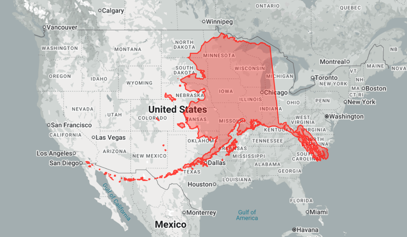
The True Size – This site lets students and teachers compare country sizes interactively, helping develop accurate spatial understanding.
USGS Geography Education – Offers reliable, curriculum-aligned geography resources and lesson materials for secondary classrooms.
OER Historical Maps – Provides ready-to-use historical maps that make teaching events and eras more visual and engaging.
Classroom Resources (optional)
Maps – These ready-to-use map activities save teachers planning time while helping students build strong geographic skills and understand world regions more deeply.
Ryan Wagoner
The Lyceum of History
“I am indebted to my father for living, but to my teacher for living well.” — Alexander the Great
Follow me on: Blog | TpT | YouTube | X | Instagram | Facebook


Leave a comment